
Rebuilding a greener Hackney: Homerton LTN set to be made permanent
Homerton’s trial low traffic neighbourhood (LTN) is set to be made permanent, following analysis of traffic data, air quality monitoring, comments from residents and a comprehensive equalities impact assessment.
The scheme is part of Hackney Council plans to rebuild a greener Hackney in the wake of the pandemic - with 19 trial low traffic neighbourhoods and 40 School Streets introduced to support people to walk, shop and cycle locally and create cleaner, greener neighbourhoods.
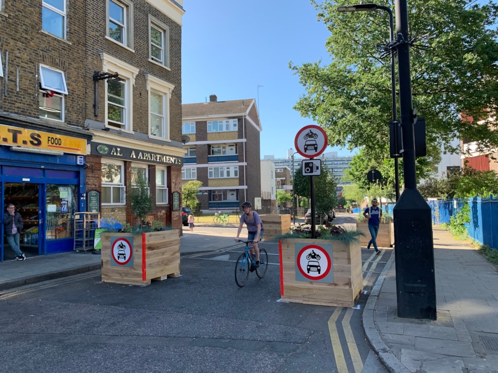
In Homerton, three traffic filters - planters in the road which permit only cyclists, emergency and waste vehicles to pass through - were installed in Barnabas Road, Ashenden Road and Meeson Street in June 2020, helping to create a low traffic neighbourhood in the area.
Analysis of traffic, air quality and bus speeds data following the LTN’s introduction shows that:
- Traffic was down by 35% inside the LTN and by 5% on boundary roads
- Air quality has improved at eight of nine monitored locations in the area
- Average bus speeds in the area have improved: from 6.9mph in 2019 to 7.2mph in 2021.
Throughout the trial, the Council encouraged people to respond to its Commonplace page, which was used to identify issues with the LTN and make changes where appropriate. 1694 responses were received in total. 1,425 of these responses were unique.
46% of responses were from the local area, with people who use a car or van to get around overrepresented in the overall results (62% of responses were from motor vehicle users, compared to the 30% of households in the borough that own a car).
Overall, 37% of Commonplace responses wanted all or some of the filters to be made permanent, with 62% saying none should be made permanent.
In the local area (those who gave E9 or E5 postcodes), 45% of responses wanted all or some of the filters to be made permanent, with 54% saying none should be made permanent.
Among people who do not use a car or van to get around, 63% wanted all or some of the LTN to be made permanent.
The top two concerns raised in resident responses were increased traffic and air pollution, which is why the Council has completed comprehensive monitoring of the scheme before making a decision on whether or not to make it permanent.
Following feedback from residents in Roding Road, the Council is also set to consult on new measures to reduce traffic there.
Traffic in Hackney has risen by 40 million miles a year between 2013 and 2019, according to Department for Transport statistics, with most of these rises taking place on neighbourhood roads, due to the increased use of sat nav apps. 40% of the traffic in Hackney does not start or end in the borough, with no economic benefit to residents or businesses.
Low traffic neighbourhoods are aimed at tackling these rises, protecting residents from through-traffic, and encouraging people to switch to walking, cycling and public transport use.
The Department for Transport issued statutory guidance to local authorities that recommends the use of Low Traffic Neighbourhoods, among other standard traffic management tools, to meet their network management duties and encourage a green recovery from Covid-19: https://www.gov.uk/government/publications/reallocating-road-space-in-response-to-covid-19-statutory-guidance-for-local-authorities/traffic-management-act-2004-network-management-in-response-to-covid-19
Read the full decision report for Homerton low traffic neighbourhood at: hackney.gov.uk/homerton-ltn.
Traffic and air quality monitoring
Traffic Change on Roads within Homerton LTN compared to pre-COVID Baseline | ||||||
Road | Baseline Date | Baselineaverage daily traffic count | November 2020 average daily traffic count | Change from Baseline (%) | May 2021 average daily traffic count | Change from Baseline (%) |
Glyn Road | Mar 2019 | 603 | 701 | +16 | 748 | +24 |
Daubeney Road (south of Ashenden Rd) | Dec 2018 | 1066 | 517 | -52 | 565 | -47 |
Daubeney Road (North of Ashenden Rd) | Mar 2019 | 1000 | 689 | -31 | 740 | -26 |
Meeson Street | Mar 2019 | 757 | 95 | -87 | 109 | -86 |
Meeson Street | Mar 2019 | 624 | 100 | -84 | 145 | -77 |
Kingsmead Way | Feb 2019 | 1130 | 1035 | -8 | 943 | -17 |
Kingsmead Way | Feb 2019 | 1031 | 1027 | 0 | 1531 | +48 |
Durington Road | Mar 2019 | 244 | 165 | -32 | 161 | -34 |
Ashenden Road | Mar 2019 | 1259 | 334 | -73 | 344 | -73 |
Roding Road (North of Ashenden Rd) | Mar 2019 | 363 | 327 | -10 | 341 | -6 |
Roding Road (South of Ashenden Rd) | Mar 2019 | 735 | 928 | +26 | 1013 | +38 |
Coopersale Road | Mar 2019 | 1058 | 460 | -57 | 768 | -27 |
Ballance Road | Dec 2019 | 1230 | 467 | -62 | 460 | -63 |
Hassett Road | Dec 2019 | 1436 | 1089 | -24 | 927 | -35 |
Barnabas Road (North of Daley Road) | May 2018 | 1518 | 754 | -50 | 1126 | -26 |
Barnabas Road (south of Berger Rd) | Dec 2019 | 3275 | 1296 | -60 | 1091 | -67 |
Barnabas Road (South of Hassett Rd) | Dec 2019 | 2477 | 999 | -60 | 1359 | -45 |
Berger Road | Dec 2019 | 1607 | 564 | -65 | 528 | -67 |
Oriel Road | Dec 2019 | 1422 | 301 | -79 | 285 | -80 |
Average % Change | - 42 | Average % Change | -35 |
Traffic Change on Boundary Roads of Homerton LTN compared to pre-Covid Baseline | ||||||
Road | Baseline Date | Baseline average daily traffic count | November 2020 average daily traffic count | Change from Baseline (%) | May 2021 average daily traffic count | Change from Baseline (%) |
Homerton Road (jw Lee Conservancy Road) | Mar 2019 | 12147 | 10293 | -15 | 13503 | +11 |
Homerton High Street jw Barnabas Road | May 2019 | 21833 | 20494 | -6 | 20848 | -5 |
Wick Road east of jw Barnabas Road | Dec 2019 | 14194 | 12532 | -12 | 13275 | -6 |
Wick Road West of jw Barnabas Road | Dec 2019 | 14619 | 13091 | -10 | 13748 | -6 |
Kenworthy Road (south of jw Ballance Road) | Nov 2019 | 16854 | 14493 | -14 | 13275 | -21 |
Average % Change | -12 | Average % Change | -5 |
Comparison of NO annual mean concentrations at monitoring locations within and on boundary roads in 2019 and 2020
Road | Air Quality Monitor (Diffusion Tube) | Within or on the boundary of the LTN | NO2 Annual Mean 2019 Concentration (ug/m3) | NO2 Annual Mean 2020 Concentration (ug/m3) |
Homerton High Street | Homerton High Street | Boundary | 48 | 36 |
Kenworthy Road | Kemey’s Street | Boundary | 32 | 27 |
Wick Road east of jw Barnabas Rd | St Dominic's 4 | Boundary | 39 | 29 |
Wick Road west of jw Barnabas Rd | Berger Primary School 2 | Boundary | 38 | 27 |
Brooksby’s Walk | Homerton University Hospital 3 | Boundary | 37 | 37 |
Barnabas Road (South of Hassett Rd) | Barnabas Road 2 | Boundary | 31 | 20 |
Barnabas Road (North of Daley Rd) | Barnabas Road 3 | Within | 31 | 20 |
Daubeney Road (south of Ashenden Rd) | Daubeney Primary School | Within | 37 | 21 |
Daubeney Road (North of Ashenden Rd) | Daubeney Primary School | Within | 37 | 21 |
Note: Any concentrations in bold are in exceedance of the annual mean NO air quality objective (AQO) 40μg/m
Low traffic neighbourhoods are important because they protect our residents from long standing rises in traffic in Hackney - 40% of which does not start or end in the borough - and they support people to walk, cycle and shop locally, improving air quality for everyone.
In the aftermath of COP26, we also need to do more to tackle transport emissions, which account for 25% of CO2 emissions in the borough.
In making the Homerton low traffic neighbourhood permanent, we have considered the reductions in traffic and air pollution, comments from residents, and completed a comprehensive equalities impact assessment, looking at the impact of the LTN on those with protected characteristics, such as race, gender and disability.Cllr Mete Coban MBE, Cabinet Member for Energy, Waste, Transport and Public Realm