
Rebuilding a Greener Hackney: London Fields low traffic neighbourhood retained
London Fields low traffic neighbourhood (LTN) is set to be retained - with some important changes - after reductions in traffic, overall improvements in air quality and an increase in cycling in the area.
The decision to retain the LTN follows analysis of comments from residents, traffic, air quality, bus speeds and cycling data.
The LTN was introduced in September 2020, and is part of plans to rebuild a greener Hackney after the pandemic - with 19 trial low traffic neighbourhoods and 40 School Streets introduced to support people to walk, shop and cycle locally and create cleaner, greener neighbourhoods.
It features six traffic filters (planters in the road that allow only cyclists, waste and emergency vehicles to pass through), bus gates (which permit buses to pass through) on Richmond Road and Pritchard’s Road, and turning restrictions at Greenwood Road, Laburnum Street and Queensbridge Road.
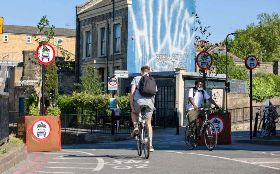
Following the LTN’s introduction, overall traffic levels in the London Fields area have improved, with traffic down inside the low traffic neighbourhood (see tables below) - including by 8,000 vehicles a day on Richmond Road (pictured).
Air quality is predicted to have improved at 147 of 169 modelled locations in the area, following analysis by air quality consultants AECOM.
Cycling rates have also increased significantly - with cycling up by between 11% and 57% on Richmond Road and Middleton Road.
On boundary roads, traffic was down on Queensbridge Road, and on some parts of Whiston Road, Kingsland Road and Mare Street.
Traffic was up on Dalston Lane and Graham Road, and on some parts of Mare Street, Kingsland Road and Whiston Road, which the Council is continuing to monitor. New live traffic monitors have been installed on Dalston Lane and Graham Road.
Overall east-west traffic in the area has decreased by 11.6%, showing some traffic is avoiding the area completely.
Following feedback during the consultation period, Blue Badge holders will be permitted to drive through the Richmond Road bus gates from 21 March.
Following comments from residents about other roads, the Council will carry out further engagement with residents on the following issues:
- Stopping traffic using Laurel Street, Forest Road and Beechwood Road to access the LTN or cut through to Queensbridge Road
- Investigate opening up the right turn into Queensbridge Road from Dalston Lane
- Investigate extending the Lansdowne Drive bus gate operating hours
- Consider additional measures for Fassett Square or relocating some filters south of Graham Road to resolve issues caused by the right hand turn ban from Graham Road
- Reduce traffic flows along Whiston Road, including by investigating measures to prevent traffic from using this as a cut through to avoid Hackney Road and Queensbridge Road
- Investigate the impacts of moving traffic filters between the A10 and Queensbridge Road to improve access for residents from the A10
- Removing the left turn restriction from Mare Street into Richmond Road
View the full delegated powers report on London Fields low traffic neighbourhood.
Traffic monitoring
The tables below compare traffic counts taken in July 2021 and November 2020 with the last available comparable count before the pandemic. Each traffic count is a daily average.
The table below shows overall east-west traffic in the area, which has decreased by 11.6%, showing some traffic is avoiding the area completely.
London Fields is our biggest low traffic neighbourhood, transforming tens of streets between Dalston and Hackney Central, supporting people to walk, shop and cycle , and tackling toxic air in the aftermath of the pandemic.
We’ve been looking closely at the monitoring results, which show traffic reduction inside the LTN, overall improvements in air quality and a significant increase in cycling.
We know that there are still things that we need to get right - which is why we’re continuing engagement with residents and why we’ve introduced live traffic monitors on Dalston Lane and Graham Road.
Cllr Mete Coban MBE, Cabinet Member for Energy, Waste, Transport and Public Realm