
London Fields traffic scheme: Updated FAQs
More than 350 people attended a public meeting on 14 December to discuss the proposed London Fields traffic filtering scheme, where further options for the area were presented to residents.
At the meeting, the Council apologised for misjudging local feeling about the scheme. The proposals were strongly supported at ward forum meetings, and these views were taken as being representative of local people. The options will go out for consultation in the New Year.
During the meeting, residents raised a number of concerns relating to the original scheme, including: whether there would be an increase in traffic and pollution on surrounding roads and if changes would affect access for the emergency services. Others wanted to know why the Council wanted to makes changes to roads in the area and questioned why the Council had wanted to launch a live trial without first consulting residents.
A summary of the issues raised at the meeting and in correspondence with residents is set out below. Most of the feedback received to date relates to the original scheme – Option 1 – however these will be updated throughout the consultation period.
It was confirmed that a consultation on a number of different schemes will begin in January 2016, and documents will be sent directly to 12,000 homes and businesses in the affected area. It will also appear on the Council’s dedicated consultation hub. Residents’ associations will also be consulted.
A series of drop-in sessions will take place, where residents can talk to officers about the options. These will take place at Queensbridge Sports and Community Centre, 30 Holly Street, London E8 1XW on:
Wednesday 27 January, 5-9pm
Wednesday 17 February, 5-9pm
Saturday 27 February, 3-7pm
FAQs
- The current proposals
- General questions
- What proportion of households in Hackney and London Fields own motor vehicles?
- Why was there no consultation before the road closure trial was announced?
- Why weren't we told earlier about the trial road closures?
- How will the success of the scheme be measured?
- Will the emergency services be able to access the area?
- Option 1
- Option 2
- Option 3
- Option 4
- Option 5
- Impact on traffic
- Pedestrian and cyclist safety
- The consultation
- What happens next?
The current proposals
What is the Council proposing?
The Council is now proposing a number of potential traffic management options to help reduce the amount of traffic using Middleton Road, and where possible the wider London Fields area. The Council is now proposing five different options:
- Area wide scheme including the closure of 13 residential junctions in the London Fields area to through-traffic - roughly a square kilometre. It is known as ‘filtered permeability’, which means pedestrians and cyclists will be able to pass through the closures but motor vehicles will not. Planters filled with winter flowers and shrubs, and where possible trees and bollards, will act as the filtering system. The area covered is from Richmond Road in the north and Scriven Street in the south, and Lansdowne Drive in the east and Haggerston Road in the west. Closures that allow buses to pass through are being proposed on Lansdowne Drive and Pownall Roa
- Closure of Middleton Road only – two closures are proposed, one between Queensbridge Road and Lansdowne Drive and one between Kingsland Road (A10) and Queensbridge Road
- A ‘bus gate’ on Lansdowne Drive, with possible additional closure to through traffic on Middleton Road between Kingsland Road (A10) and Queensbridge Road. An explanation of a bus gate is provided below
- Width restrictions on Middleton road at two locations – one between Queensbridge Road and Lansdowne Drive and one between Kingsland Road (A10) and Queensbridge Road. Width restrictions are intended to deter the largest vehicles from using Middleton Road (Vehicles wider than 6’ – 6” (2.0m)
- Any ideas/options residents wish to put forward to help reduce the volume of traffic using Middleton Road, and where possible the wider London Fields area.
Why are you doing this?
For a number of reasons. Middleton Road forms part of the Bloomsbury to Walthamstow Quietway and we want to reduce the volume of vehicles using Middleton Road in order to create a safer environment for cycling. We want to attract a broader range of people to cycling, particularly those who are less confident on busy roads such as recreational cyclists, women, children, families, older people etc. A lot of social research has been undertaken in recent years by various groups and organisations, such as TfL, and the perception of road danger has been identified as one of the key barriers that is preventing a lot of new people from cycling.
Increasing walking and cycling is a key policy objective for the Council due to the wider benefits of sustainable transport in reducing pollution and road danger, along with improving personal mobility and public health, which is a significant issue in Hackney. Greener transport journeys have risen considerably in this area, and the borough in general, in recent years (cycling in Hackney has more than doubled in the last decade), and this scheme forms part our strategy to continue increasing the number of people choosing to travel by cleaner methods of transport, particularly walking and cycling.
We also want to create cleaner and quieter neighbourhoods, which are better places for the majority of residents to live and for children to play.
Why was this area chosen?
Middleton Road has historically formed part of the London Cycle Network and is now part of a new Mayor of London ‘Quietway’, linking Bloomsbury in central London and Walthamstow to the east. Middleton Road is already used by a large number of cyclists each day and we hope and expect this will increase. TfL has provided local councils with funding to make improvements to the new Quietway routes around London to make them safer for cycling and we are using this as a funding opportunity to investigate reducing the amount of through-traffic in the area.
What proportion of households in Hackney and London Fields own motor vehicles?
According to the 2011 Census (the most reliable data available), 65% of households in Hackney don’t have a motor vehicle. This is a 9% reduction on the 2001 census figures. In the London Fields ward, approximately 50% of households do not have a motor vehicle. In Greater London, 54% of households do not have a motor vehicle.
Why was there no consultation before the road closure trial was announced?
The Council had planned to trial a road closure scheme in the New Year and consult residents at the same time. This idea was developed at ward forum meetings. The Council has since acknowledged that it misjudged the strength of local feeling and took this feedback as representative of the local area.
Instead, the Council will now hold an extensive public consultation, starting in January, which will allow residents to have their say on a number of options, before any decisions are made. The data will be independently analysed by a market research organisation, to ensure that residents can have full confidence in the integrity of the analysis. We hope we can move forward in the New Year with something that has broad public support.
General questions
Why weren’t we told earlier about the trial road closures?
Until late October, the plans were still in design-stage. Early plans were presented at the London Fields ward forum meeting in July in order to make local residents aware of our intentions and the response was largely positive. The Council released some initial information on the scheme in October/November 2015 at short notice in response to coverage on social media and in the local press, on the basis that a trial road closure scheme would be introduced in the new year and residents consulted at the same time. In response to public interest in the proposal the Council will now be undertaking a full consultation instead.
How will the success of the scheme be measured?
The objective of the scheme is to improve the Quietway route, and where possible the wider area. Ideally, the Council would like to reduce the volume of traffic using Middleton Road to less than 2,000 vehicles per day – although this is not an absolute requirement. A successful scheme is one where the benefits of the changes to the route, and to residents in the area, outweigh any dis-benefits, taking into consideration all roads in the area. Traffic flow and pollution levels would, of course, be carefully monitored and taken into account when assessing the success of any scheme, and changes would be made accordingly, in consultation with residents.
Will the emergency services be able to access the area?
Where options include road closures, emergency vehicles will be able to pass through the closures due to the special types of bollards that would be used. We have already successfully trialled these bollards in Pitfield Street, Shoreditch. This will mean there is minimal delay for vehicles on emergency
For the option that includes width restrictions on Middleton road – these will be designed to allow emergency vehicle access.
Emergency service vehicles will be allowed to use the bus gates.
The emergency services are statutory consultees, which means, by law, the proposals must be discussed with them and any views/concerns taken on board. We are having ongoing discussions with colleagues in the fire, ambulance and police services on all options now being presented to understand their views, and any concerns they may have.
Option 1
Are there other motor traffic reduction schemes like Option 1 in London?
Yes – it is common for motor vehicle access to be restricted in some residential streets. Transport authorities usually implement this type of policy in response to requests from residents who are seeking to enhance their quality of life by reducing the volume of non-local motor traffic near their homes.
In some cases roads are looked at on an individual basis and in other cases entire areas are looked at to try and minimise the likelihood of traffic displacing onto adjacent streets.Some schemes have also been progressed to achieve significant safety benefits for cyclists and pedestrians, with fewer interactions between vulnerable road users and motor vehicles. Examples in Hackney include:
Brownswood area: bounded by Green Lanes, Seven Sisters Road, Blackstock Road and Mountgrove Road – approximately 15 streets.
Lower Clapton area: bounded By Homerton Road/High Street – Urswick Road – Lower Clapton Road – Lea Bridge Road – more than 60 roads.
What impact would Option 1 have on parking?
These proposals would have a very low impact on parking. Minimising the impact on parking has been a key consideration in developing the proposals. Further details on specific locations where parking will be impacted will be available during the consultation.
Would Option 1 be bad for local businesses?
We recognise that all businesses have different servicing needs, and we are happy to work with them to address any specific concerns/issues that might arise from the proposals.
However, we do not expect these proposals to have a negative effect on local businesses. All existing access to properties by motor vehicle would be retained, and there would be minimal effects on parking. Some motor traffic journeys could become longer, while many cycle and walking journeys would become more attractive. There is evidence that pedestrians and cyclists frequently spend more money per week in local shops than those travelling by car, with walking and cycling customers spending less per visit but more overall by making more visits.
There is also evidence showing that small businesses overestimate the proportion of their customers who arrive by motor vehicle (sometimes by twice as much), and underestimate then number who walk and cycle. They also tend to overestimate the distances that customers travel to their business.
Would Option 1 mean more pollution and traffic on other roads?
For some of the options, particularly the area wide scheme in Option 1, some local motor journeys might become slightly longer. We do however believe that the net effect of that option will be to encourage more walking and cycling, providing a long-term reduction in air pollution by reducing the amount of vehicles using the road (both local and through traffic).
In all the options there is, of course, a potential for traffic to displace into nearby streets. However, we do not expect all traffic to switch to these roads. Previous schemes have shown that there tends not to be a direct shift on to adjacent streets for all those currently using a particular route. We predict that some extra motor traffic may use some of the other roads in the area, dependent on the option, but many journeys originate outside the immediate area and we predict that some people will avoid the neighbourhood completely, some will alter their journey habits, and others will switch to other modes, such as walking and cycling. We believe that the area wide scheme (option 1) is likely to be the most comprehensive option in terms of trying to discourage through-traffic from using the area completely and encouraging more walking and cycling in general.
Undertaking any changes, should a decision be made to proceed with one of the options, on a live trial basis will allow the Council to accurately quantify the impacts of the changes on all roads in the area under real life conditions rather than using predictions or speculation as to what may or may not occur. This will then help inform any future decision making.
The Council is currently looking to undertake some air quality modelling in advance of the trial to allow effective monitoring during the trial process to understand any air quality impacts.
Option 2
Would Option 2 mean more pollution and traffic on other roads?
Option 2 includes the closure of Middleton Road only to through traffic at two locations. Local access to the area would be less restrictive when compared to Option 1 and many local journeys would remain unaffected. A larger number of alternative routes through the area would however still be available for traffic and so there may be a higher chance of traffic displacing onto adjacent roads, but this is by no means guaranteed.
As per the comments for Option 1, should a decision be made to proceed with one of the options, this would be done on a live trial basis will allow the Council to accurately quantify the impacts of the changes on all roads in the area under real life conditions rather than using predictions or speculation as to what may or may not occur. This will then help inform any future decision making.
What impact would Option 2 have on parking?
Apart from some minor changes where the two road closures would be located in Middleton Road there will be no impact on parking within the area.
Option 3
What is a ‘bus gate’?
A bus gate is a road closure that allows buses, cycles, and any other authorised vehicles to pass through (such as the emergency services or Council waste vehicles). A bus gate does not have a physical obstruction/measure to prevent general traffic from passing through the closure and is reliant on cameras for enforcement. Bus gates have been successfully used in a number of places across London. A photo of a bus gate is shown below.
Would Option 3 mean more pollution and traffic on other roads?
Option 3 includes a Bus Gate in Lansdowne Drive, with possible additional closure to through traffic in Middleton Road between Kingsland Road (A10) and Queensbridge Road.
Local access to the area would again be less restrictive when compared to Option 1 but more restrictive than Option 2, as traffic would not be able to enter the area from Westgate Street. Similar to Option 2, a number of alternative routes through the area would still be available for traffic and so there may be a higher chance of traffic displacing onto adjacent roads, but again this is not guaranteed.
As per the comments for options 1 and 2, should a decision be made to proceed with one of the options, this would be done on a live trial basis will allow the Council to accurately quantify the impacts of the changes on all roads in the area under real life conditions. This will then help inform any future decision making.
What impact would Option 3 have on parking?
As per Option 2, apart from some minor changes where the Bus Gate would be located in Lansdowne Drive, and by the possible additional closure in Middleton Road, there would be no impact on parking within the area.
Option 4
What is width restriction?
A width restriction is a section of road that has been narrowed so that only vehicles of a certain size (width) or smaller can pass through. Width restrictions are used to prevent larger vehicles from using a road. The minimum width the Council can legally restrict the road to is 6’ – 6” (2.0m), but will generally use 7’ – 0” (2.25m). A photo of a width restriction is shown below.
Would Option 4 mean more pollution and traffic on other roads
Option 4 includes width restrictions in Middleton Road to prevent larger vehicles using the road. The majority of private cars and smaller commercial vehicles would be unaffected by the restrictions.
Local access to the area for the vast majority of residents would remain unchanged.
Based on current traffic flow figures we expect that the width restrictions would prevent around 10-15% of vehicles currently using Middleton Road from doing so (approximately 400-600 per day). Alternative routes will be available through the area and so there is a possibility that some traffic that is no longer able to use Middleton Road will use nearby alternatives.
As per the comments for previous options, should a decision be made to proceed with one of the options, this would be done on a live trial basis will allow the Council to accurately quantify the impacts of the changes on all roads in the area under real life conditions. This will then help inform any future decision making.
What impact would Option 4 have on parking?
Some minor changes would be required in Middleton Road near to the proposed width restrictions but there would be no other impacts on parking within the area.
Option 5
I’ve got an idea which isn’t included in the current proposals. How do I tell the Council?
There will be an opportunity to share ideas which haven’t yet been raised during the consultation.
Impact on traffic
Can I still get to my home/business/school by car?
Yes, for all of the proposed options the roads are not closed, so residents will still be able to drive on them. However, dependent on the option you may have to take a slightly longer route – particularly Option 1 (area wide scheme).
Has any traffic modelling been completed?
Traffic modelling to predict the impacts of the changes has not been undertaken for this scheme. The development of traffic models of this type is an extremely lengthy and costly process and is reserved for major road schemes that are likely to significantly impact on the main road network in London. E.g. new roads, major gyratory removals, etc.
Modelling is a useful tool in helping predict the impacts of changes to roads that carry a significant proportion of London’s traffic, but they have limitations in terms of reflecting driver behaviour and how well they represent dense local road networks such as the one in this area.
Given the limitations/margin of error with modelling of this type and the significant time and cost implications, the Council believes a live-trial is a more cost-effective approach in this instance.
Would motor traffic journeys for residents take longer?
Some motor traffic journeys would take longer (depending on the route), but this would be balanced against the benefits of living in an area that has significantly less motor traffic. Less motor traffic would mean a safer road, and less noise and air pollution.
Would I still be able to drive to and park outside my home, business or workplace?
Yes. Existing vehicle access would be maintained to all properties, although some people would need to use different routes - potentially longer ones - because some junctions would be closed to motor traffic.
What about other roads or locations in the area?
The funding the Council currently has available for this area has come from Transport for London to make improvements to the Quietway Cycle Route – which runs along Middleton Road. Ideally, the Council and TfL would like to reduce the volume of traffic using Middleton Road to less than 2000 vehicles per day.
While the Council is trying to use this as an opportunity to achieve wider objectives such as creating safer and quieter neighbourhoods, and making travel by foot and bike safer and easier, the Council must be able to show TfL that the funding has been used to make improvements to the Quietway Route.
We recognise that there are a range of traffic and transport issues in this area, and more generally across the borough, and we have already received feedback from some residents raising concerns about a number of roads in this area. We will be asking some additional questions in the consultation about some of these roads, and if residents have comments or concerns about these, or any other roads in the area, then we encourage respondents to include this in their consultation response.
Does the Council have Traffic Flow data for roads in the area? How was this information collected?
The Council has traffic flow data for the majority of roads in the area. A plan of the area in PDF format with a summary of the traffic flow data is included on the Council’s website. A table showing the busiest roads is provided below.
The traffic flow data for the area was collected in Autumn 2014, Spring 2015 and Autumn 2015 - to help build up picture of traffic flows. The information was collected using pressure tubes laid across the road over a continuous seven day, 24 hours a day period. The tubes record vehicle flows and individual vehicle speeds for analysis. This type of data collection is used by all highway authorities for recording traffic flow and speed
Why have different traffic flow figures been quoted on social media?
The latest traffic flows data for Middleton Road, between Kingsland Road and Queensbridge Road, is 4,600 - as shown on the traffic flow map. Traffic volumes in Middleton Road would appear to have stayed relatively consistent over the last three to four years.
The Council has generally been using 5,000 vehicles per day as the figure in any discussions, rounding the recordedrr count data to the nearest 1,000.
Some surveys were completed in 2009, which recorded volumes in Middleton Road of 7,500 -8,000 per day, totalling 53,000 per week.
Pedestrian and cyclist safety
Will there be more and faster cyclists in my area because of the new Quietways route?
The Quietways Route is one of a number of initiatives being delivered by councils and TfL to improve safety and encourage more people to cycle. We recognise that a number of faster commuter cyclists currently use the route and will continue to do so. However, the main aim is to attract a wider range of new people to cycle, particularly those who are less confident on busy roads such as recreational cyclists, women, children, families, older people, and so on. Attracting a much wider range of people is the key focus of all the current investment in cycling within London, it is not just about providing faster routes for commuters.
How will you deal with inconsiderate cycling and improve pedestrian safety?
Hackney is aware that some residents have concerns over inconsiderate cycling, and this is a major challenge in terms of helping sell the benefits of cycling to residents and the wider public. We work closely with cycling groups, the police and a range of other organisations to deliver extensive publicity, training, awareness and enforcement programmes to encourage cyclists to use the roads considerately and safely. The Council is happy to look at any specific locations for targeted work in these areas.
However, it is important to recognise that inconsiderate cyclists are the minority, the same way that inconsiderate motor vehicle drivers are the minority.
Could you include additional proposals to improve safety, particularly for pedestrians?
The Council feels that motor traffic is the main risk to pedestrians, and to all other road users, and is this supported by collision statistics across London. Removing through traffic therefore represents the most significant safety improvement on these roads. However, the Council recognises that residents and pedestrians have concerns over high volumes of cyclists and pedestrian/cycle conflict and so residents can put forward suggestions for additional improvements along the route and where possible these will be taken into consideration. While the Quietway Route is clearly a cycle scheme, the Council have included improvements that aim to benefit all road users, particularly pedestrians, such as the improved junctions at Middleton Road/Haggerston Road and Middleton Road/Lansdowne Drive
Would vehicles doing three-point turns in the road put pedestrians and cyclists at risk?
We accept that if roads are closed to through motor traffic, then some vehicles would have to execute three-point turns in order to access a property and then leave along the same road. We would ensure that adequate space for turning vehicles, where necessary and practical, is provided to ensure businesses could be serviced adequately.
We are not aware of any evidence that slow vehicle manoeuvres of this type pose a significant risk of harm to pedestrians, cyclists or other road users in Hackney or elsewhere in Greater London. We are confident that any minor negative impacts of turning traffic are outweighed by the safety benefits of removing a significant number of vehicles in peak hours from local roads.
Would reducing motor traffic encourage more muggings and burglaries?
It might sound intuitive that a road without through motor traffic is more prone to crime because it is ‘quieter’ but, according to the Metropolitan Police, people in cars do not typically provide an effective source of natural surveillance for an area because of their high speeds. Encouraging slower-moving cyclists and pedestrians could increase natural surveillance if they are encouraged to use the route by the removal of through motor traffic.
Our analysis of crime figures has not found that crime is more prevalent in roads that are closed to through motor traffic than those where through motor traffic is allowed. For these reasons, we don’t expect our proposal to affect crime levels.
We will however continue to discuss the options with the Police during the Public Consultation to ensure that any concerns they may have are taken on board as part of the decision making process.
The consultation
How can I have my say?
The Council will be conducting a 10-12 week public consultation starting in early January on the options detailed above. The consultation material, with questionnaire, will be delivered to approximately 12,000 households within the London Fields area, asking for residents’ views. Residents, businesses and members of the public will also be able to reply to the consultation online. The Council is currently planning three drop-in events in the area in January and February. Dates and venues for the drop-in events will be included in the public consultation information packs and are listed in the introduction section of this document . Officers will be available at the drop-in sessions to discuss the plans, and the area in general, in person. In early January the Council will look to arrange meetings with local residents’ associations in the area.
How can we be sure that the consultation will be conducted fairly?
The data will be independently analysed by a market research organisation, to ensure that residents can have full confidence in the integrity of the analysis. We expect that any subsequent decision as to whether to proceed with a preferred option, if there is one, will be taken by Cabinet.
Can I support some of the closures to motor traffic but not others?
For Option 1 (area wide scheme) the 13 closures to motor traffic are designed to work together, and with existing closures to motor traffic in the area, in order to reduce through motor traffic throughout a wider area.
For Option 2 (Middleton Road only) and Option 3 (Lansdowne Drive Bus Gate with possible additional Middleton Road closure) the focus is Middleton Road and reducing the amount of through traffic using the Quietway Route
Option 4 does not include any road closures
If residents have comments or concerns about a particular closure in any of the options, then we encourage them to include this in their consultation response. There is scope to move some closures, yet still prevent through motor traffic through the same roads.
When will a decision be made and by whom?
At present the Council anticipates the results of the consultation to be available by May 2016. At this stage a decision will then be made on the next steps. The Assistant Director, Public Realm, would normally make any decision but given the high level of interest in the scheme and scale of any changes we expect that a decision will be referred to Cabinet.
What happens next?
What is the time scale?
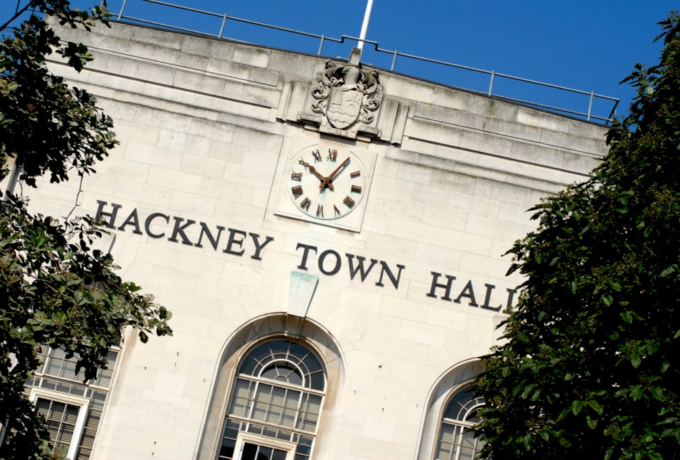
- December 2015 - Public Meeting held at Town Hall. Feedback from meeting reviewed including initial comments on suggested options
- Early January 2016 - Public consultation 10 – 12 weeks with 12,000 properties receiving a questionnaire and free return envelope
- January-February 2016 - Three drop-in sessions and meetings with residents' associations
- April – May 2016 - Consultation independently analysed by market research organisation
- Early summer 2016 - Results/decision