
Emergency road safety measures: Further 20 roads set to close to through-traffic
A further 20 roads in Hackney are set to close to through-traffic to aid social distancing and support walking and cycling, as part of radical emergency road safety plans being developed by the Council.
The Council has successfully secured funding from Transport for London’s Streetspace programme for all of the closures, nine of which would create new low traffic neighbourhoods in Hoxton West, and the Haggerston and London Fields area.
Closures at a further 11 roads around the borough are targeted at residential areas known to be used as rat-runs by drivers keen to avoid main roads, and would improve road safety in these areas.
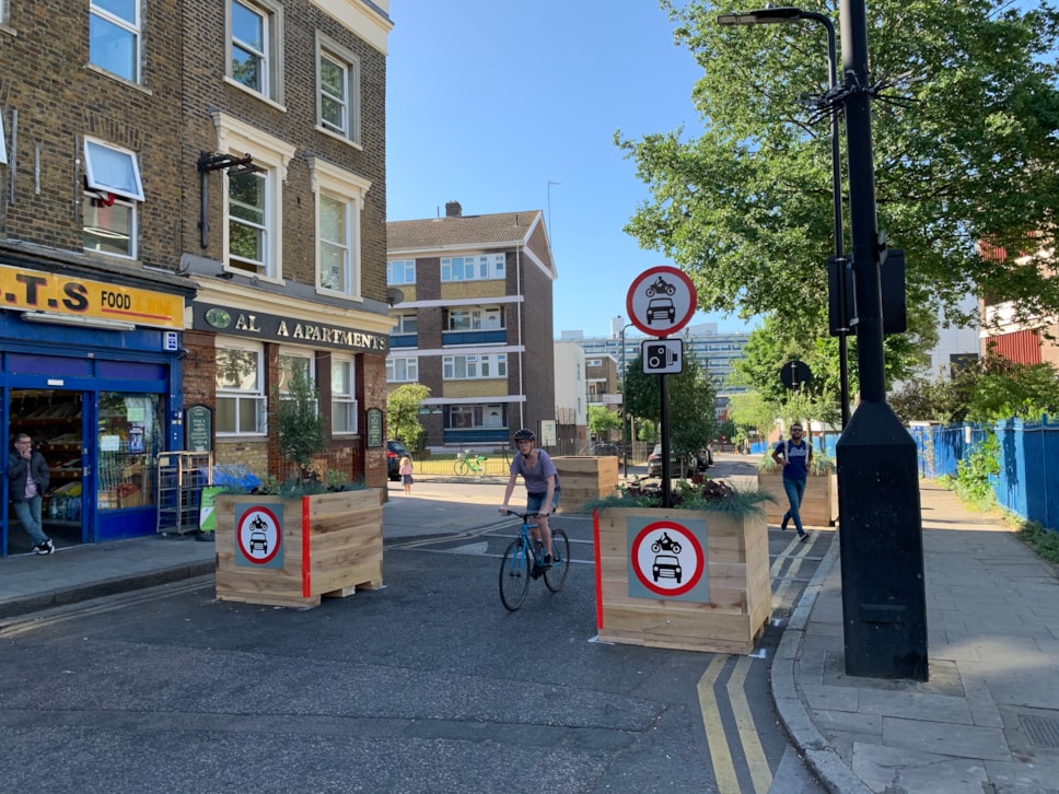
As with the Council’s existing emergency road closures at Barnabas Road, Ashenden Road, Gore Road and Ufton Road, the closures will restrict through-traffic, allowing only pedestrians and cyclists, and emergency vehicles to pass through.
People would still be able to access homes and businesses from either side of the closures.
The closures form part of the Council’s post-lockdown transport strategy, which will also see roads outside 40 schools closed to traffic to help children walk and cycle to school.
The measures will be implemented temporarily under experimental traffic orders for a maximum period of 18 months, giving residents the chance to have their say on how they work in practice before a decision is made on whether or not to make them permanent.
Letters will be sent to residents in the area around every closure, outlining how they can have their say.
Because the proposals to create temporary low traffic neighbourhoods in Hoxton, and Haggerston and London Fields affect more than one ward, these were considered and approved by the Council’s Cabinet last night.
Hoxton closures
In Hoxton, road closures would be introduced on: Shepherdess Walk, Nile Street and Ebenezer Street. These changes would build on the Council’s work on Micawber Street on the Central London Cycle Grid, which has improved facilities for both cyclists and pedestrians. It would also prevent drivers from using this residential area to bypass the main road network, and Old Street Roundabout in particular.
Haggerston/London Fields closures
In the Haggerston/London Fields area, closures would be introduced on: Pritchards Road (near the Cat and Mutton bridge), and Forest Road, Richmond Road, Middleton Road/Haggerston Road, Dunston Street and Lee Street to the east of the A10 in Haggerston. The proposals would support the Council’s bus gate and School Street at London Fields Primary School, reduce traffic around new cycle lanes on Queensbridge Road, and help to reduce traffic on Richmond Road in the London Fields area.
Over the past two years, the Council has also hosted a series of workshops to inform proposals for additional closures around Richmond Road nearer to London Fields. It will be writing to residents to outline plans for these.
Additional closures
The additional 11 roads that are set to close to through-traffic are: Weymouth Terrace, Springfield (filter at Springfield Gardens) and Southwold Rd banned turn, Elsdale Road and Mead Place, Cremer Street, Clissold Crescent, Marcon Place, Hertford Road, Shore Place, Wayland Avenue and Felstead Street.
Post-lockdown emergency transport strategy
In addition to the measures it has already introduced, and the 40 new School Streets announced this month, the Council is developing a post-lockdown recovery transport strategy, and further measures could include:
- A significant number of road closures to help support residents to walk and cycle
- Measures to improve strategic cycle routes through the borough
- Schemes in two of the borough’s town centres to aid social distancing and support people to walk, cycle and shop safely
- Expanded road safety programmes and cycle training for local residents
The Council will be releasing its full strategy over the coming weeks. All of the measures will be introduced using Experimental Traffic Orders, allowing residents to have their say about how they are operating, which the Council will take into account before deciding whether to make them permanent.
Residents can find out more at hackney.gov.uk/coronavirus-transport-strategy.
We know that 70% of people in Hackney do not own a car, yet there is a clear risk that as lockdown eases and public transport use remains low the number of cars on our roads will increase. In a borough with the highest number of cycling and walking road deaths in London per 1000 trips taken, and one of the highest premature death rates from air pollution, any increase in motor vehicle traffic is likely to be deadly. It is my duty to ensure that doesn’t happen.
We are acting quickly to close roads and widen pavements to support walking and cycling, protect people from increased traffic, and prevent the secondary effects of coronavirus from exacerbating existing road safety issues, deadly air pollution, and the transport emissions that are driving the climate emergency. Our approach is consistent with City Hall and the Government, which has advised local authorities to make significant changes to their road layouts to give more space to cyclists and pedestrians.Cllr Jon Burke, Cabinet Member for Energy, Waste, Transport and Public Realm
Our world-leading Streetspace for London programme is transforming our city to enable many more journeys to be made by bike and on foot. I’m delighted that Hackney Council is continuing to take ambitious and bold action to create more space for walking and cycling at a time when this is more important than ever, and currently has the highest number of Streetspace schemes. I urge other councils to follow their lead and help prevent one public health crisis being replaced with another.Will Norman, London Walking and Cycling Commissioner